|
LandMap Vivo
 LandMap Vivo creates own true scaled Landmaps with GPS enabled, integrated online aereal fotos.
The Vivo technology is the key revolution of this version.
Aereal and satellite fotos and roadmaps are loaded from the web, stored local and used directly and rapidly without internet.
this means: own maps without own data: no scann of paper maps, no order of official maps.
LandMap Vivo will draw directly areas on the aereal foto and view instantly the area size(hektars, acres);
analyse GPS-tours on the background of aereal fotos and road maps;
print true to scale without background.
It has import ready road maps and orldwide database with GPS enabled and can edit, format in "LandMap Vivo", measure areas.
The material is absolutely free of any licence fee.
you can reate GPS-enabled vector maps in "Google Earth", copy/paste them to "LandMap Vivo" and make all what you cannot do in "Google Earth" with it.
| Software Information |
System Requirements |
| Version: |
10.00 |
- Windows 8/7/XP/Vista
- 512 MB RAM
|
| File Size: |
6.36 MB |
| License: | Free to try, $65.00 to buy |
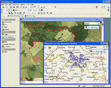
| Screenshot: | View Screenshot
|
| Rating : |  |
Key Functions of LandMap Vivo:
- Create GPS enabled geo maps directly on the background of aereal photos and road maps from the internet
- Import geodata from Google-Earth, OpenStreetMap, GPS tracks and GPS logger
- Map editor , manually digitizing
- Specifical graphical objects (borderlines, borderareas) to guarantee exact same borders of neighbour areas
- Layer management
- Insert own symbols (trees, building, etc.), labeling the map
- Screen calibration for true to display on the screnn
- Free scalable
- Measurements: area size (hectares, acres) of an arbitrary number of areas; total area, net area, restricted area; recorgnizes automatically embedded areas; measure of paths.
- True to scale print of map sections
- Export to "Google Earth" as vector map
- Export as Pixel-Image (jpg, gif, png, tiff, bitmap)
RELATED
SOFTWARE DOWNLOADS FOR LANDMAP VIVO
- GenealogMap
easy to use genealogy software with flexible user interface, visual represent, publishing, and Web site creation features
- GPSeasyCE
easy to use map software for PocketPC & PocketPC 2002. It use raster maps which are eithe
- Light Map Maker - creates lighting effects
real-time 3D developers, Light Map Maker can creates compelling lighting effects quickly
- PolyMap DataBase Edition
PolyMap is a desktop mapping and geographic presentation software package for Windows to create thematic and informative maps for presentations
- Flash Map US States Silver
with FLA source for web sites, interactive applications, presentations, and more.
- Frontbase GPS
is garmin software that makes it to transfer waypoints, routes and tracks between your Garmin GPS and PC
- Capturix GPS SDK
is a ActiveX OCX Control that provide Visual Basic Developers the interface between GPS receivers and their applications.
- Skylab GPS Simulator
basically generates NMEA-0183 GPS sentences. It offers a broad variety of configuration capabilities.
- GPS for Google Earth
converts the free Google Earth version into a GPS Navigation for Laptop or Netbook.
- MASPware GPSmeter
MASPware GPSmeter is an All-in-One solution for GPS-Routing and measurements and analysis.
- 3D World Map
can view our planet in 3D,and get reference on 269 countries and entities,locate and compare more than 30000 cities around the world,compute distance between any two points on the globe,and more.
- Global Mapper 9
is more than just a viewer capable of displaying the most popular raster, elevation and vector datasets.
- Map Export
is a GIS developer oriented tool for downloading and exporting background image.
- MapIT Designer
MapIT Designer enables you to map out and communicate your complex decision-based knowledge.
|
|


 BestShareware.net. All rights reserved.