|
GPS for Google Earth
 GPS for Google Earth" converts the free Google Earth version into a GPS Navigation for Laptop or Netbook.
The own GPS-position it shown and tracked in real time in "Google Earth". Also by night, with fog or mist you'll
see your current movement like on a bright day on the screen. Each tour is automatically recorded. One may
play animations of formerly recorded GPS logs. Each one how owns a Laptop or Netbook has with "GPS for Google Earth"
a navigation tool for the road, offroad, on the water or on the air. In addition one needs only a little GPS receiver.
There's no need to bye a full navigational system. A so called GPS mouse or a GPS USB dongle are available in low cost level.
GPS for Google Earth" converts the free Google Earth version into a GPS Navigation for Laptop or Netbook.
The own GPS-position it shown and tracked in real time in "Google Earth". Also by night, with fog or mist you'll
see your current movement like on a bright day on the screen. Each tour is automatically recorded. One may
play animations of formerly recorded GPS logs. Each one how owns a Laptop or Netbook has with "GPS for Google Earth"
a navigation tool for the road, offroad, on the water or on the air. In addition one needs only a little GPS receiver.
There's no need to bye a full navigational system. A so called GPS mouse or a GPS USB dongle are available in low cost level.
The connection may be established by cable, USB or Bluetooth. The software itself is'nt restricted to a special manufacturer.
The program works with each GPS Receiver that provides NMEA. But this is the case for all commercially available receivers.
The program is'nt retricted to only one country. The GPS reception works all over the world and is independent of the internet.
Even in fare-away places you'll find a way there and back. Even without mobile internet one may use the system out
of the home. "Google Earth" remembers images and maps once shown in the screen in its so called Cache memory.
If you revise calmly at home all interesting areas (you plan to visit on a tour) in "Google Earth" with an
active internet conmection, all this maps stay available in "Google Earth" even after disconnecting the internet.
Now you may take the Latop into the car or on the boat and will have all necessary maps "in the bag".
| Software Information |
System Requirements |
| Version: |
2.0 |
- Windows 8/7/XP/Vista
- IBM PC compatible;
- 512 MB RAM;
|
| File Size: |
3.73 MB |
| License: | Free to try, $32.00 to buy |
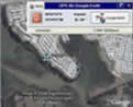
| Screenshot: | View Screenshot
|
| Rating : |  |
RELATED SOFTWARE DOWNLOADS FOR GPS FOR GOOGLE EARTH
- OggSync
is pleased to announce OggSync suite of products.
- Sync2It's BookmarkSync for Mac OS X
keeps your favorites synchronized on all your machines and all of your browsers
- GPSeasyCE
easy to use map software for PocketPC & PocketPC 2002. It use raster maps which are eithe
- Frontbase GPS
is garmin software that makes it to transfer waypoints, routes and tracks between your Garmin GPS and PC
- Capturix GPS SDK
is a ActiveX OCX Control that provide Visual Basic Developers the interface between GPS receivers and their applications.
- GpsGate Express for Pocket PC
is a software program that allows you Share a GPS over a network, ActiveSync, Bluetooth or HTTP.
- GpsTools Pro .NET
Franson GpsTools makes it really simple to develop GPS, tracking, mapping and basic GIS applications in Visual Studio.
- Skylab GPS Simulator
basically generates NMEA-0183 GPS sentences. It offers a broad variety of configuration capabilities.
- GentleMouse
is a patent-pending, ergonomic software that clicks the mouse for you
- Halftone Search for Google Desktop
is all-in-one tool extending Google Desktop Search. It includes set of additional drivers for indexing files and shell for search files using GDS.
- Site Sniper Pro 2
Automatically create super powerful and laser targeted Google site-targeted AdWords campaigns that convert like crazy!
|
|


 BestShareware.net. All rights reserved.