|
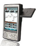
MASPware GPSmeter
 Do you still use your GPS device for navigating only?
Now MASPware GPSmeter 5 is an All-in-One solution for GPS-Routing and measurements and analysis.
Turn your Pocket PC into a high precision metering machine using your GPS receiver! With MASPware GPSmeter you can measure
short and long distances (beeline or routelength), altitude differences, areas, timespans, average values and min-max-values
using an internal or external GPS receiver.
Whether measuring you golf drives, watch your running- or biking sessions, the route length to you work or whatever. Everythings
no problem!
Precision depends on the GPS receiver you use. MASPware GPSmeter improves accuracy by calculating averages of position datasets.
Furthermore, MASPware GPSmeter uses a High-Precision-Algorithm to evaluate precision values of the GPS receiver (Dilution of
precision values).
So MASPware GPSmeter only uses high precision dataset values. Additionaly, you can use expert precision settings, to enforce
needed precision!
| Software Information |
System Requirements |
| Version: |
5.03.3435 |
- Windows Mobile 5/6
- Pocket PC 2003/Professional/Classic
|
| File Size: | 8.20 MB |
| License: | Free to try, $38.16 to buy |
| Screenshot: | View Screenshot |
| Rating : |  |
Key Features of MASPware GPSmeter:
- Integrated Measurement Administration
- Waypoint Administration(incl. pictured waypoints)
- Full Graphical Analysis
(Altitude and Speed Profil) incl. point value views
- Track/Area Visualisation incl. Multiple Picture Overlays and onlinemaps!
- Fully Customizable Detailed View
- Full Bordcomputer
- Support for free gps tracker quoox|TRACKER
- 1-click-mapcalibration using OverlayCalibrator
- Onlinemaps usable in mapview
- Optimized for geotagging (e.g. for photos)
- Area measurements using markers
- Multipe overlays
- NMEA0183 compatibel (supports nearly all gps receivers!)
- NMEA logging and playback
- Supports wired, wireless (bluetooth) and integrated GPS receivers
- Automated gps detection
- Metric, nautic and statute/imperial(US/UK) system
- DMS,DM,DS and UTM, SwissGrid or Maidenhead coordinate view
- GeoFence Feature - a virtual gps fence
- Compare two measurements
- Full automated auto-saving-ability
- Own expert settings (e.g. DOP-Thresholds)
- Run in background, e.g. use navigation tool at the same time
- Stopwatches for additional time measurments
- Export to Google Earth, GPX and CSV (Raw-Data)
- Google Earth KML and GPX import
- One-time measurements, to use for short and quick measurements
- Incl. time/length (e.g. time/mile) view for runners
- Real support for high resolution screens!
- Add warnings (speed, altitude, battery)
- Automated Updates
- Send positions vid eMail or SMS
RELATED SOFTWARE DOWNLOADS FOR MASPWARE GPSMETER
- GPSeasyCE
easy to use map software for PocketPC & PocketPC 2002. It use raster maps which are eithe
- Frontbase GPS
is garmin software that makes it to transfer waypoints, routes and tracks between your Garmin GPS and PC
- Capturix GPS SDK
is a ActiveX OCX Control that provide Visual Basic Developers the interface between GPS receivers and their applications.
- GpsGate Express for Pocket PC
is a software program that allows you Share a GPS over a network, ActiveSync, Bluetooth or HTTP.
- GpsTools Pro .NET
Franson GpsTools makes it really simple to develop GPS, tracking, mapping and basic GIS applications in Visual Studio.
- Skylab GPS Simulator
basically generates NMEA-0183 GPS sentences. It offers a broad variety of configuration capabilities.
- GPS for Google Earth
converts the free Google Earth version into a GPS Navigation for Laptop or Netbook.
- AgMapper For Windows Mobile
AgMapper For Windows Mobile is GPS mapping software for Windows Mobile driven Pocket PC's.
|
|


 Do you still use your GPS device for navigating only?
Now MASPware GPSmeter 5 is an All-in-One solution for GPS-Routing and measurements and analysis.
 BestShareware.net. All rights reserved.


