|
Total GIS Converter
 Total GIS Converter is a powerful converter on GIS files. It converts AEP, GRD, ADF, E00, FLT, APR, SHP, DXF,
BT, TOC, RT1, DEM, DLG, ECW, IMG, DGF, GML, SID, MIF, TAB, WOR, DNG, DDF, BIL, TIF, JPEG, TTKPS, TTKGP, TTKLS, LFT,
PFT, and TFT files.
Total GIS Converter is a powerful converter on GIS files. It converts AEP, GRD, ADF, E00, FLT, APR, SHP, DXF,
BT, TOC, RT1, DEM, DLG, ECW, IMG, DGF, GML, SID, MIF, TAB, WOR, DNG, DDF, BIL, TIF, JPEG, TTKPS, TTKGP, TTKLS, LFT,
PFT, and TFT files.
The output formats include TIFF, PNG, JPEG, BMP, PDF.
Note that 5Mb of vector format file extropolates into 2Gb in graphic format like BMP.
Total GIS Converter can scale the files for your convenience.
Total GIS Converter can be handled via command line. Besides, any file can be converted right from your desktop
due to the ability of Total GIS Converter to integrate into Windows pop-up menu.
You do not have to risk your money. First download the free version of Total GIS Converter and try to convert your files.
| Software Information |
System Requirements |
| Version: |
1.0.0 |
- Windows 8/7/XP/Vista
- 256 MB (512 MB or more recommended)
- CPU: 500 MHz or faster
|
| License: | Free to try, $99.90 to buy |
| Download Size: | 4.47 MB |
| Screenshot : |
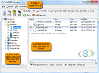
View Screenshot |
| Rating : |  |
The list of supported formats:
- ArcExplorer Project File - aep
- ArcInfo ASCII Grid - grd
- ArcInfo Binary Grid - adf
- ArcInfo Export Format - e00
- ArcInfo Float Grid - flt
- ArcView 3.xx Project File - apr
- ArcView Shape Files - shp
- Autocad - dxf
- Binary Terrian Grid - bt
- CADRG - toc
- Census 2000 TIGER/Line - rt1
- Digital Elevation Model (ASCII Grid or SPOT)- dem
- Digital Line Graphs DLG - dlg; opt
- Enhanced Compressed Wavelet - ecw
- ERDAS IMAGINE Image File Format - img
- Geographic Data Files - gdf
- Geographic Markup Language - gml
- Lizardtech MrSID - sid
- MapInfo Interchange Format File - mif
- MapInfo Native Format - tab
- MapInfo WorkFile - wor
- Microstation Native Format - dgn
- SDTS Raster Profile and Extension - ddf
- SDTS Topological Vector Profile - ddf
- SPOT Binary In-line Format - bil
- Tag Image File Format - tiff; tif
- JPEG File Interchange Format - jpg; jpeg
- TatukGIS PixelStore - ttkps
- TatukGIS Project File - ttkgp
- TatukGIS SQL Layer - ttkls
- Vector Product Format VPF- lft; pft; tft
RELATED SOFTWARE DOWNLOADS FOR Total GIS Converter
- Total Folder Monitor
Total Folder Monitor watches your folder and in case a new file is added executes predefined action.
- Total CAD Converter
Total CAD Converter will convert CAD to tiff, pdf, jpg, png, dxf.
- OakDoc PCL to IMAGE Converter
OakDoc PCL to IMAGE Converter optimizes and manipulates Image files.
- iWinSoft Image Converter for Mac
iWinSoft Image Converter for Mac converts PDF/PNG/JPEG/GIF/TIFF/EPS/PICT/BMP/SGI.
- Aiseesoft Total Video Converter
Aiseesoft Total Video Converter converts video to AVI/MP4/MKV/WMV.
- PDF to ePub Converter
PDF to ePub Converter is a powerful utility which converts your PDF files to ePub file easily and quickly. Also can converts HTML, XML, TEXT, Gif, JPEG files into an ePub file.
- AnyBizSoft PDF Converter for Mac
AnyBizSoft PDF Converter for Mac can convert PDF to Word, Excel, PowerPoint, EPUB, Text and HTML.
|
|


 BestShareware.net. All rights reserved.