|
Global Mapper
 Global Mapper is a GPS Mapping Software application capable of displaying the most popular raster,
elevation, and vector datasets. It converts files to different formats, mosaics multiple images
into single files, reprojects GIS data, edits, prints, and allows you to utilize GIS functionality on
your datasets in one low cost and easy to use software package.
Global Mapper is a GPS Mapping Software application capable of displaying the most popular raster,
elevation, and vector datasets. It converts files to different formats, mosaics multiple images
into single files, reprojects GIS data, edits, prints, and allows you to utilize GIS functionality on
your datasets in one low cost and easy to use software package.
Global Mapper also includes the ability to directly access multiple online sources of imagery, topographic maps,
and gridded terrain data. This includes access to worldwide high resolution color imagery from
Digital Globe/GlobeXplorer/AirPhotoUSA (watermarked access for free) and access to the entire TerraServer-USA database
of USGS satellite imagery and topographic maps free-of-charge. Global Mapper also has the ability to
easily access WMS data sources, including built-in access to elevation data and color imagery for
the entire world, and to view elevation data in true 3D with any loaded raster imagery
and vector data draped on top of it!
Global Mapper is a comprehensive software package which includes much more functionality than listed here.
| Software Information |
System Requirements |
| Version: |
14.1 |
- Windows 8/7/XP/Vista
- Pentium II CPU
- 512 MB RAM
|
| License: | Free to try, $399.00 to buy |
| File Size: |
44.2 MB |
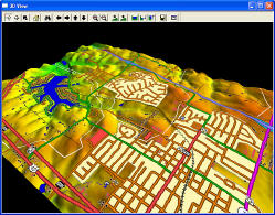
| Screenshot : |
View Screenshot |
| Rating : |  |
Global Mapper - GPS Mapping Software Features:
- Global Mapper supports viewing of dozens of the most common data formats:
DLG-O, DRG, DOQ, DEM, DGN, DTED, DWG, DXF, SDTS DLG, SDTS DEM, ECW, MrSID, ESRI Shapefiles, E00,
JPEG2000, CADRG/CIB, GeoTIFF, KML/KMZ, Lidar LAS, Arc Grid, Tiger/Line And many, many more!
- Provides direct access to Digital Globe, GlobeXplorer, and AirPhotoUSA high resolution color satellite imagery for the entire world from within the application!
- Provides direct access to the complete TerraServer-USA satellite imagery and topographic map archive for the entire US free-of-charge within the application!
- Provides easy, direct access to WMS data sources, including built-in access to the complete 30-m NED database, the 3-arc second world SRTM database, and color global imagery free-of-charge within the application!
- Supports true 3D viewing of loaded elevation data including draping of any loaded imagery and vector data over the 3D surface.
- Crop, reproject, and merge any combination of raster data and elevation data, including DRGs. You can also crop data to an area feature.
- DIGITIZING SUPPORT! You can digitize new vector (area, line, and point) features by drawing them with the mouse. You can also edit existing vector features. Newly created and editing features can be saved to any of the supported export formats. In addition, shapes like rectangles, circles, ellipses, arcs, and concentric range rings. can be easily drawn as well.
- GPS SUPPORT! You can track a compatible GPS device connected to your computer's serial port or USB port in real-time over any loaded data. In addition, you can mark waypoints at the current GPS location and record a tracklog of where your GPS device has been while connected, all seamless with your loaded map data!
- PROJECTION/DATUM SUPPORT - Global Mapper supports accurate conversions between a large list of projection systems and datums. NAD27 datum conversions in the US use the NADCON conversion method, and the NTv2 datum conversion method is used for the NAD27 (Canada), AGD66, AGD84, and NZGD49 datums. Custom datum conversions can be easily added in either 3-parameter or 7-parameter form if a required datum transformation is not already supported.
- EXPORT SUPPORT! You can export both vector, raster, and elevation data to a variety of formats (see below). You can merge any combination of data sets, regardless of source scale, type, and projection. You can also breakup your data into a regularly spaced grid on export if you'd like as well.
- IMAGE RECTIFICATION! You can graphically rectify (georeference) any JPG, TIFF, or PNG image and save the results to a new fully georeferenced image. Vector data can also have a rectification process applied to it after loading to allow morphing vector data to fit other data sets.
- CONTOUR GENERATION! You can create contours for any combination of elevation data. You can also specify the contour interval to use. The generated contour data can then be exported to any of the supported vector export formats (see previous item for a list).
- Automatic triangulation and gridding of 3D point data sets, such as ASCII XYZ files. This allows you to convert a set of elevation samples into a fully gridded data set, which can then be used for contour generation, line of sight analysis, and view shed analysis, among other things. The data can also be exported to any of the supported elevation grid formats, such as USGS DEM.
- Support for combining/comparing terrain surfaces, such as DEMs. This allows you to generate a new terrain surface by combining/comparing two loaded terrain surfaces with operations like subtraction (difference), averaging, and min/max. The results can then be exported to any of the supported elevation grid formats, such as USGS DEM.
- NASA World Wind Support! Any loaded data can be exported to JPG or PNG image tiles setup for immediate display in NASA's World Wind application. The necessary .xml file is also automatically generated.
- Google Maps Support! Any loaded data can be exported to JPG or PNG image tiles setup for immediate display using Google Maps in a web browser. The necessary HTML file is also automatically generated.
- Advanced screen capture. You can capture the contents of the screen to a BMP, JPG, PNG, or (Geo)TIFF file of user-specified resolution.
- Batch conversion of almost any input data data files to any compatible export type.
- Auto-clip collar for DRGs. You can now have the collar of USGS DRG files automatically clipped off. This allows you to seamlessly view a collection of adjacent DRG files.
- Supports opening SDTS DLG, SDTS DEM, and most other file types directly from .tar.gz and .zip archives. This saves the major headache of decompressing each SDTS transfer into a separate directory.
- Comprehensive view shed analysis using loaded elevation grid data from a user-specified location, transmitter height, and radius.
- 3D Path Profiling and Line of Sight (LOS) capabilities, including receiver/transmitter heights, minimum clearance, and earth curvature options.
- Advanced measurement capabilities, including multi-segment path lengths and headings, enclosed area, and cut-and-fill volume calculations either along a path or within an enclosed area.
- Ability to link vector feature attributes to web sites or files.
- Support the latest DEM and SDTS DEM formats, including decimeter DEMs.
- Supports opening DLG-O and DEM files directly from gzipped archives. This means that you can save space and hassle by not having to decompress the data after you download it.
- Slide over text. When you move your cursor around the screen you'll get a description of the nearest feature automatically displayed in the status bar.
- Supports keyboard navigation. You can pan about with the arrow keys and zoom in/out with the page up/page down keys.
- Search and edit load vector data by name, attribute value, or description.
- And much more!
RELATED SOFTWARE DOWNLOADS FOR Global Mapper
- Triplehash Hutmil
is an individual and batch image, web page and generic file editing program for Batch image operations and Global website changes
- Raster to Vector Converter SDK (DLL)
Raster to Vector Converter SDK (DLL) can convert raster image into vector image, and output into dxf or text file. The format of raster image include bmp, jpg, tiff, pcx and tga
- Acme CADPacker - Dwg Dxf to exe conversion
is tool software for issuing and viewing CAD graphic files. With CADPacker, you can pack your design files, project explanations, photos and design effect drawings (DWG, DXF, TXT, BMP, JPEG, TGA, PCX, GIF, WMF) into self-executive exe file.
- TraceART - Raster to Vector Converter
is a professional Raster to Vector Converter program (Vectorizer) Convert Raster to Vector (DXF,WMF,HPGL,EPS,SVG,CGM,PDF)
- RasterStitch
is a utility for putting together multiple raster images to create a panorama of several photographs.
- Vextractor
is a vectorizer software for transforming raster images into vector formats by building centerlines and outlines.
- AlgoLab Raster to Vector Conversion Toolkit
Converts architect, mechanical and various technical drawings, mapsand other types of line artwork ...
- AlgoLab Photo Vector
is a handy tool for designers and CAD/CAM professionals to create, cleanup, make fast corrections, edit designs and create input to CAD/CAM systems including CNC vectors.
- Vector Graphics ActiveX
is the professional graphics solution for creating business and technical drawings and the most powerful for today
|
|


 BestShareware.net. All rights reserved.