Make BestShareware.net your home page Add BestShareware.net to your favorites  

Homepage

Help Desk

Site Map

Popular

What's New

Featured
Search Software:
WWW         BestShareware.net
  MAC Software | Linux Software | Pocket PC | iPod Software | Zune Software
  Software Directories
Internet
Graphics
PC Tools
Applications
Development
DVD & Video
MP3 & Audio
Computer Games
Security & AntiVirus
  Graphics
Graphic Converter
Icon Maker
Icon Tools
Screen Capture
Photo Editor
Screensaver Maker
Screensavers
SlideShow Maker
Animation Maker
Calendar Maker
Graphic Tools
Teacher Tools
Graphics Viewers
3D Modeling & CAD
HoudahGeo

HoudahGeo for mac 
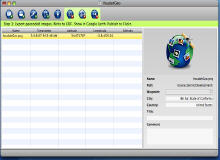
HoudahGeo is a really cool photo geocoding software for the Mac. With HoudahGeo you may "pin" photos to the locations where they were taken.
The thus created information may be exported to EXIF tags as well as to Google Earth KML files. Such a file allows for browsing your photos within Google Earth.
You don't need a digital camera with a built-in GPS
You need HoudahGeo, a Mac software solution for geocoding photos with latitude, longitude and altitude information.
HoudahGeo provides the same functionality as a GPS camera, but without having to deal with the bulk or the expense. And - for less money - HoudahGeo does a lot more...
You don't need a GPS device. HoudahGeo may operate in a fully automatic mode when provided a track log file from a GPS receiver. Finer control is possible by attaching photos to waypoints created using a GPS device.
When no GPS device is available, manual geocoding is possible through integration with the Google Maps service.


Software Information System Requirements
Version: 1.4.10
  • Requires Mac OS X 10.4 or later.
  • It is fully compatible with Mac OS X 10.5 Leopard.
File Size: 5.57 MB
License:Free to try, $43.08 to buy
Screenshot:View Screenshot
Rating :

HoudahGeo Features:
  • iPhoto and Aperture integration
  • Automatic geocoding from a GPX or NMEA track logs
  • Data download from many USB or Bluetooth GPS track loggers
  • Manual geocoding using Google Earth (NEW!)
  • Manual geocoding using Google Maps
  • Precision geocoding from GPX way points
  • EXIF/XMP/IPTC image file tagging
  • Google Earth export
  • Upload your images directly to Flickr.com. Share your mapped photos.
  • HoudahGeo splits the geocoding process into 3 easy steps. No hassles!


  RELATED SOFTWARE DOWNLOADS FOR HOUDAHGEO
  • RoboImport
    is a Camera and CardReader Image Automation Software


  • Zoner Panorama Maker
    based on a wizard that helps you make panoramas easily


  • FirmTools PanoramaComposer
    Brainlessly simple software for creating stunning panoramas from digital photos.


  • RasterStitch
    is a utility for putting together multiple raster images to create a panorama of several photographs.


  • Calico for Mac OS X
    is a new automatic multi-row stitcher for the casual photographer.


  • Digital Camera Data Recovery Software
    Recovery utility recover deleted files, including DOC, XLS, JPG, digital camera photos, ZIP, RAR, DBX, PST, email, MP3, MPEG and more.


  • DiskInternals Flash Recovery
    It is a flash memory file recovery tool that every digital camera owner should have handy.


  • Auto Photo Editor
    Image processing, image resizer, graphic converter, photo editor, picture editor, image editor, editing photo, remove red eyes.


  • Web Photo Search
    is a picture finder and picture downloader software utility that helps you search and download images from the Internet


  • ZC Dream Photo Editor
    Blend pictures and create a pretty composition of two images


  Submit Software | Privacy Policy | Terms of Use | Advertise with Us | Contact Us
 Copyright © BestShareware.net. All rights reserved.