|
Eye4Software GPS Toolkit Professional
 Eye4Software GPS Toolkit Professional is an ActiveX/COM component which allows software developers to add GPS
functionality to their programs and scripts, without the need for any knowledge on serial communications and GPS protocols.
Eye4Software GPS Toolkit Professional is an ActiveX/COM component which allows software developers to add GPS
functionality to their programs and scripts, without the need for any knowledge on serial communications and GPS protocols.
Eye4Software GPS Toolkit Professional offers functionality to read and decode NMEA0183 and Garmin PVT data, as well as
performing coordinate conversions between geodetic datums and coordinate systems using various map projections, including
Transverse Mercator, Oblique Mercator, Mercator, Lambert Conformal Conic, Lambert Azimuthal Equal Area, Polar Stereographic,
Oblique Stereographic, Albers Equal Area, Eckert IV and VI, Mollweide, Krovak, Cassini-Soldner and more.
This ActiveX component can be used in various programming environments, such as Visual Studio .NET, Visual Basic, Visual C++,
Visual Basic .NET, Visual C# .NET, Borland Delphi and Visual Basic for Applications (VBA). Supported also are web oriented
applications such as ASP, ASP.NET and PHP.
| Software Information |
System Requirements |
| Version: |
2.4.9.1106 |
- Windows 2000/XP/2003/Vista/7/2008
- NMEA-0183 compatible (D)GPS device
|
| File Size: |
595 KB |
| License: | Free to try, $323.08 to buy |
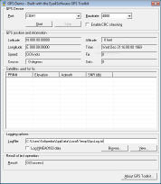
| Screenshot : | View Screenshot |
| Rating : |  |
Main Features of Eye4Software GPS Toolkit Professional:
- Retrieve and decode NMEA-0183 position data from a GPS device
The toolkit will handle all the serial communications from the GPS device, and converts the received NMEA-0183
sentences into usable data, which can be used directly in your software and / or scripts.
- Use Garmin GPS devices connected using USB
Most Garmin devices are shipped with an USB instead of a serial cable these days. The protocol used by Garmin is
called PVT. The toolkit can communicate directly with the USB driver to read position data from these GPS devices.
The data which can be retrieved over the PVT protocol is the same as described for the NMEA-0183 protocol above.
- Perform geodetic datum and map grid transformations
The latitude and longitude coordinates from either the GPS or set by the user, can be translated to any map datum
or map grid around (for instance to UTM), by just using the built in "GpsProjection" object.
- Advanced NMEA-0183 features
It is possible to filter incoming NMEA sentences by message type and talker-id. This can come in handy when multiple
NMEA devices are connected to the same port, using for instance a NMEA-0183 data combiner, and you want to decode data
only from either a GPS (GP TalkerID ) or Compass (HC TalkerID ). Using the filter, if needed you can also force the
toolkit to extract the position from the GLL string rather then the GGA string.
RELATED SOFTWARE DOWNLOADS FOR EYE4SOFTWARE GPS TOOLKIT PROFESSIONAL
- Frontbase GPS
is garmin software that makes it to transfer waypoints, routes and tracks between your Garmin GPS and PC
- Capturix GPS SDK
is a ActiveX OCX Control that provide Visual Basic Developers the interface between GPS receivers and their applications.
- GpsGate Express for Pocket PC
is a software program that allows you Share a GPS over a network, ActiveSync, Bluetooth or HTTP.
- GpsTools Pro .NET
Franson GpsTools makes it really simple to develop GPS, tracking, mapping and basic GIS applications in Visual Studio.
- Skylab GPS Simulator
basically generates NMEA-0183 GPS sentences. It offers a broad variety of configuration capabilities.
- MASPware GPSmeter
is an All-in-One solution for GPS-Routing and measurements and analysis.
- LandMap Vivo
creates own true scaled Landmaps.
|
|


 BestShareware.net. All rights reserved.